<b>Kolka</b>, R., C. <b>Trettin</b>, W. Tang, K. Krauss, S. Bansal, J. Drexler, K. Wickland, R. Chimner, D. Hogan, E. J. Pindilli, B. Benscoter, B. Tangen, E. Kane, S. Bridgham, and C. Richardson, 2018: Chapter 13: Terrestrial wetlands. In Second State of the Carbon Cycle Report (SOCCR2): A Sustained Assessment Report [Cavallaro, N., G. Shrestha, R. Birdsey, M. A. Mayes, R. G. Najjar, S. C. Reed, P. Romero-Lankao, and Z. Zhu (eds.)]. U.S. Global Change Research Program, Washington, DC, USA, pp. 507-567, https://doi.org/10.7930/ SOCCR2.2018.Ch13.
Terrestrial Wetlands
The objective of this chapter is to characterize the distribution of carbon stocks and fluxes in terrestrial wetlands within North America. The approach was to synthesize available literature from field measurements with analyses of resource inventory data to estimate wetland area, carbon stocks, and net ecosystem exchange (NEE) of carbon and methane (CH4) fluxes of terrestrial wetlands (see Appendices 13A and 13Bf for details1). Then, the findings employed from large-scale simulation studies provided additional context, with consideration given to the effects of disturbance regimes, restoration and creation of terrestrial wetlands, and the application of modeling tools to assess the carbon cycle of terrestrial wetlands.
13.1.1 Terrestrial Wetland Definition
This chapter focuses on carbon cycling in nontidal freshwater wetlands (referred to hereafter as “terrestrial wetlands”). Although there are various definitions of terrestrial wetlands (Cowardin et al., 1979; IUSS Working Group WRB 2006), all recognize a high water table level as the driver of biological and chemical processes characteristic of wetlands. The United States defines wetlands as soils that are inundated or saturated by surface or groundwater at a frequency and duration sufficient to support, and that do support under normal circumstances, a prevalence of vegetation typically adapted for life in saturated conditions (U.S. EPA 2015). The distribution of U.S. wetlands is considered on the basis of vegetation and hydrogeomorphical setting using remote-sensing data (Federal Geographic Data Committee 2013). Soils are also indicative of wetland conditions; two major soil types useful for assessing carbon stocks and fluxes recognized here are mineral soils and organic soils. Wetland ecosystems with organic soils, also known as peatlands, are classified as Histosols by the U.S. Department of Agriculture (USDA) Natural Resources Conservation Service (NRCS) Soil Survey (Soil Survey Staff 2010). The Histosol order represents soils with a thick (>40-cm) accumulation of organic matter on top of mineral sediments or rock. Most Histosols are formed under wet conditions (e.g., peat soils), but some of these soils form under aerated conditions. Not considered a wetland, aerated Histosols are distinctly recognized (e.g., suborder Folists) and thus are not considered here. However, all peatlands are formed under wet conditions (Joosten and Clarke 2002), and they are classified as wetlands in Canada (Zoltai and Vitt 1995) and throughout North America (Gorham et al., 2012). The amount and distribution of accumulated soil organic matter reflect the balance between inputs from vegetative production and losses from decomposition or overland transport (e.g., erosion or drainage). While the depth for defining organic soils (Histosols) or peatlands ranges from 10 to 50 cm among different countries, the USDA Soil Survey uses the top 40 cm in the upper 80 cm of soil, which is the definition used here (Soil Survey Staff 2010). Mineral soil wetlands vary widely in the composition and depth of the surface organic layer, varying from a few centimeters to nearly 40 cm in histic-mineral soil wetlands (“histic” refers to soils with a 20- to 40-cm organic horizon, differentiating them from Histosols).
13.1.2 Relationship to Other Chapters and SOCCR1
For this chapter, assessments were made of terrestrial wetlands that occur in boreal, temperate, and tropical climatic zones in Canada, the United States, Mexico, and Puerto Rico. Tidally influenced saltwater and freshwater wetlands are assessed in Ch. 15: Tidal Wetlands and Estuaries. Terrestrial wetlands, including peatlands, occurring in the Arctic permafrost zone are assessed in Ch. 11: Arctic and Boreal Carbon. Some types of wetlands are transition zones to inland waters (e.g., riparian wetlands). This report considers that inland waters (see Ch. 14: Inland Waters) begin at the shoreline of lake, reservoir, and fluvial systems. Both Ch. 9: Forests and this chapter use the definition of forests from the USDA Forest Service’s Forest Inventory and Analysis (FIA). As a result, there is overlapping data between Ch. 9 and this chapter. Also, Ch. 10: Grasslands describes wetlands in those domains and thus has some overlapping data with this chapter. Similarly, there are overlapping data with Ch. 12: Soils where organic and mineral soil wetlands are assessed. Since Ch. 5: Agriculture includes no jurisdictional wetlands, it does not have overlapping data.
In the First State of the Carbon Cycle Report (SOCCR1; CCSP 2007), the Wetlands chapter (Chapter 13; Bridgham et al., 2007) was inclusive of all terrestrial and tidal wetlands, from tropical to Arctic ecosystems. In the Second State of the Carbon Cycle Report (SOCCR2), wetlands are assessed in several chapters as described above.
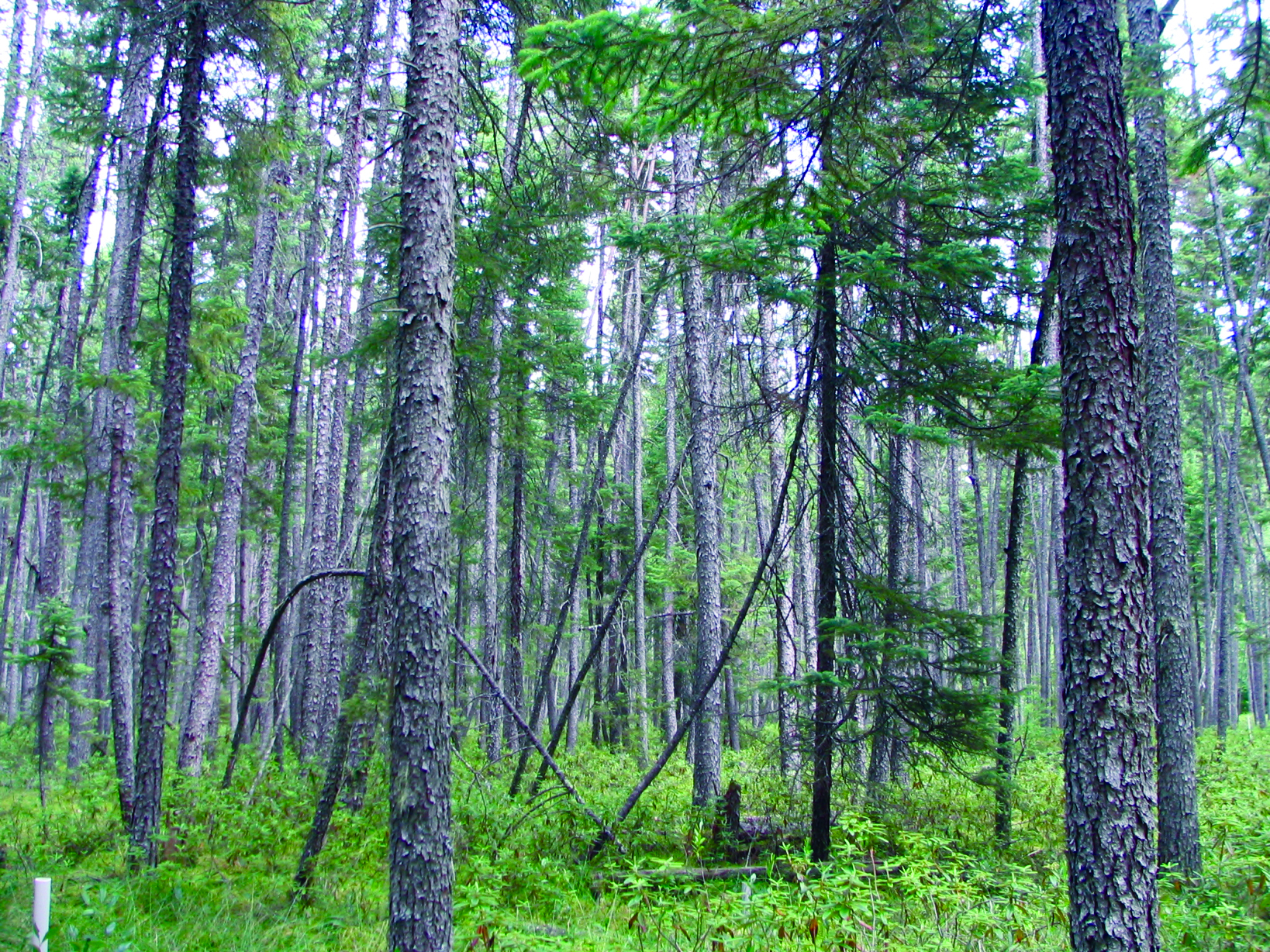
This chapter adds new information on carbon pools and fluxes from terrestrial wetlands that occur in boreal, temperate, and tropical climate zones within North America. It breaks down carbon pools and fluxes between mineral soil wetlands and peatland ecosystems. It also differentiates carbon pools and fluxes between forested and nonforested wetlands (not done in SOCCR1) because of the influence of trees on ecosystem carbon dynamics (see Figure 13.1). The term “flux” is used for carbon dioxide (CO2) and CH4 as the net balance between uptake and release of these gases relative to the atmosphere. Finally, this chapter reviews dissolved organic carbon (DOC) fluxes from terrestrial wetlands as well as restored wetlands, but it does not consider constructed wetlands or detention ponds, which typically are engineered systems.
Figure 13.1: Forested Peatland in Northern Minnesota